Union Minister of State for Environment and Forests Jairam Ramesh has reiterated India's commitment to deepening regional cooperation and institution-building in the fields of environment, forestry and climate change.
Mr. Ramesh was in Nepal last week to inaugurate a conference organised by the International Centre for Integrated Mountain Development (ICIMOD), which works on fragile mountain eco-systems and livelihoods of mountain people in the Hindu Kush-Himalayan region.
In an exclusive conversation with The Hindu, Mr. Ramesh said India was intensifying its relationship with the ICIMOD. “Between 1983 and 2006, we gave $1 million to the regional organisation. In three years alone — 2009, 10 and 11 — India would contribute half-a-million dollars to the ICIMOD.” The ICIMOD's areas of operations include India, China, Pakistan, Afghanistan, Nepal, Bangladesh, Myanmar, and Bhutan.
More details...
This platform will enable the participants of the different events during the Symposium to interact virtually, stay updated on the ongoing sessions and provide a room for debate and creative exchanges.
Sunday, October 10, 2010
Friday, October 8, 2010
IISD News
International Symposium on Adaptation in Himalayan Region Highlights Role of Earth Observations
The Symposium was hosted by the International Centre for Integrated Mountain Development (ICIMOD) and focused on: remote sensing of the cryosphere; spatial decision support systems for ecosystems; space-based information for disaster management; land-cover change and carbon stocks; transboundary air pollution monitoring; and spatial data infrastructure for adaptation. More...
The Symposium was hosted by the International Centre for Integrated Mountain Development (ICIMOD) and focused on: remote sensing of the cryosphere; spatial decision support systems for ecosystems; space-based information for disaster management; land-cover change and carbon stocks; transboundary air pollution monitoring; and spatial data infrastructure for adaptation. More...


Thursday, October 7, 2010
SERVIR Regional Inception Workshop 7 October 2010

On 7 October the SERVIR-Himalaya Inception Workshop officially introduced the new SERVIR system at the Headquarters of the International Centre for Integrated Mountain Development (ICIMOD) in Kathmandu. The one-day workshop on "SERVIR-Himalaya: Expectations and Challenges" was organized by ICIMOD in cooperation with the United States Agency for International Development and the U.S. National Aeronautics and Space Administration (NASA). SERVIR is an earth observation, monitoring, and visualization system that integrates satellite and other geospatial data for improved scientific knowledge and decision-making by managers, researchers, students, and the general public. Such improved scientific knowledge will be beneficial in the areas of disaster management, biodiversity conservation, transboundary air pollution monitoring, snow and glacier monitoring and mountain ecosystem management.
The workshop focused on four thematic areas: 1) Identification of stakeholders and key applications; 2) Priority products and services; 3) Policy issues; and 4) Institutional arrangements for participation and collaboration in SERVIR. More details...
Valedictory Session of the International Symposium on Earth Observation

During a Panel Discussion on the last day of the International Symposium distinguished participants resumed their take-away and action points in a plenary session. Professor Fukui proposed an integration of the regions online portal sites that have so far served the purpose of making data available to end users, in particular on issues of mitigation. He further emphasized the importance of communication within stakeholders, not only in this region but international, he encouraged a review process of the symposium outcomes, to take the cooperation a step further. Prof Li Jing saw the Symposium as a good platform to tap many resources. He suggested to also keep in mind that it is not only data but information which can be understood by the end user that is needed, in particular especially during disasters. That is why the platform could be used to share more than data, but best practices in production and technology.
Dr Thomas Painter made three points on the importance of face-to-face encounters, the applicability of the data for those implementing and youth’s role to ask questions. “Make sure that the answers you get make sense, if not, ask again. And we as the scientific community should do the same”. Soonchang Yoon commented that there is a need for concrete and accurate numbers on climate change from earth observation, as well as sound modeling and the creation of an inventory. To carry out earth observation through ground, satellite and airborne observation regional cooperation will be key in sharing the costs. In the same line, Yussif Hussin encouraged regional cooperation in capacity-building.
Jeffrey Kargel showed himself struck by the solid achievements in the form of SERVIR and the JAXA receiving station, which in his view are “semanting some of the longstanding contributions between the wealthy world and ICIMOD.” Further he saw humans as the key to understanding and supporting mountain systems: those living in them, those studying them, and those benefiting from change, downstream, and there are those that must solve problems: “Most notably the young, who will really have to grapple with the successes and failures of my generation.”
Following the deliberations participants gave their comments on the way forward after the symposium. Ramesh Maski, from Kathmandu University asked for suggestions on how to bridge the dissemination gap, in particular at the level of research institutions. Two participants from Bangladesh asked for a mechanism to access real-time data, in particular for disaster situations. Furthermore, the suggestion was made for ICIMOD to include the downstream effects of climate change – which are mainly affecting Bangladesh – to be studied as well. Further suggestions aimed at the inclusion of a regional mechanism to coordinate ground observation were also made. Finally, a representative from the youth forum asked for concrete suggestions on how youth as a stakeholder can get involved.
The chair, Tej Partop, summed up the discussion. He showed himself happy that “everybody seems to have realized the need for cooperation, need for a glue, a platform, and the role for institutions like ICIMODO.” For him the most important way for youth to get involved was to increase the critical mass of expert human resources. During the discussions he found one dimension missing, which is that of those communities already affected by climate change, such as many farming communities. Finally he suggested a future reinforced focus on the impact of snow and rainfall. Co-chair Madhav Karki underlined the role of the media and it to be more knowledge-based and informed.
ICIMOD DG Andreas Schild in his concluding remark showed himself overwhelmed with the wide participation and the political support given by ministers and agencies. He expressed his special thanks to the support received during the seminar from JAXA, NASA, USAID, and key personalities of Minister Shri Jairam Ramesh, Charles Bolden, Michael Yates and Jose Achache. In his message to the youth he picked up Bolden’s remarks: “Don’t wait to be invited, take initiative”. Schild expressed his gratitude for the many suggestions and the trust given to ICIMOD. “It is an enormous responsibility. You are expecting our staff not only to be very proficient, they also have to be able to interpret data and be able to respond to the users’ needs. It is a noble task, which will need assistance of international resource centers to make it possible.”
The session was closed by a vote of thanks by Basanta Shrestha, MENRIS Head and main symposium organizer. He was delighted about many collaborations, with NASA, USAID, GEOSS, JAXA and most recently the Chinese Meteorological Administration. His final thanks went to all the delegates and his ICIMOD team. “The kind of vibration I could feel not only during the sessions but everywhere, is calling for a new beginning.”
Speech by Hari Priya of the Youth Forum during the Valedictory Session Oct 6
An era of consumerism, an era of unsustainable practices, an era of lack of responsibility towards planet Earth. Yes, welcome to the anthropocene era that finds its luxury and happiness by slowly poisoning lives around. These words might sound cruel, but it is evident that we, the sixth sensed species are spreading like an incurable infection on the planet, disturbing the delicate balance of the earth’s climate.
Honourable Dignitaries, Delegates of the International Symposium and friends from the media, Namasthe, Good Afternoon. I am Haripriya Madhavan from India. Today I feel privileged to represent my young friends from 8 countries belonging to the Hindu Kush Himalayan region, to share the experiences we had during the 6 days of the forum on Empowering Youth with Earth Observation Information for Climate Action.
Understanding GIS and remote sensing, learning about landscape changes in HKH region, snow-cover mapping, glacier inventories and disaster risk management, performing numerous hands-on activities, listening to power-packed guest lectures by experts from ICIMOD and the supporting organizations – That was a fraction of what the youth forum equipped all of us with, in such a short period of time. Yet, it is so fascinating to realize the impact this learning could have on our community when we go back home and advocate about consequences of climate change on the HKH region. We are indeed thankful to ICIMOD because this forum has helped us to feel more attached to mountain ecosystems, especially the Himalayas, our pride and heritage that we must conserve for our future generations. We, the participants now have the responsibility to tackle our area-specific impacts of climate change by connecting with potential solution makers to fuel immediate mitigation action and also build capacities of communities to adapt. The youth forum has made us recognize the power of communication and effective sharing as key necessities for securing our future.
We look forward to play a vital role in building decision support systems with the help of Earth Observation tools and resources. Thus, with the wisdom and will of the experienced and the energy and ideas that we have, we the youth are committed to transform our world into a better place for ourselves and the young of the future.
If you have assumed that the participants of the youth forum are a group of only environmental science graduates, you are probably wrong because we also have a good representation from youth belonging to the social sciences and media background. Being a media student myself, it is my duty to voice the concerns of this section as well. Media is a platform with immense potential to reach the people at their doorsteps and desktops. So it is essential that the issues surrounding climate change are given prominent space in newspapers, television, radio and online news portals. Hence, we urge the media community to bridge your knowledge gaps in the field of climate change in order to ensure responsible coverage backed with the necessary follow-up and not just momentary reporting. Moreover, a participatory approach to involve the people, especially vulnerable communities, in the process of reporting, popularly known as citizen journalism, could enable media to act as catalysts of change in the society.
At the outset, we also have a message for the women community at this international forum. We are considered as creators of the human race. Hence it is our duty to take up the mission of conservation as a challenge to prove our willpower and determination in protecting our Earth. What we require is women activism to combat climate change.
We might represent different professions, different genders, different communities, different ideologies, but we are all under one sky, as humans, humans with love for each other. We are not deterred by differences. We, the youth are concerned about a secure future not just for ourselves, but for the entire human kind. We do not want our children to be born as environmental refugees. We do not want to see suffering and pain in the eyes of our kith and kin whose lives are dependent on the Himalayan ecosystem. The fact that the countries from the HKH region are extremely dependent on climate sensitive sectors makes us the most likely victims of failing crops, potential famine, floods and disease. We do not want to wait for major disasters to happen, which is why we look up to our leaders and policy makers of our respective countries for immediate affirmative action.
The message from the youth forum is going to be a beginning in itself – for advocacy based on good science, for building regional and international cooperation, for responsible action, and we hope, for good governance as well. I would like to share with you an inspirational quote by one of my friends, “What will decide the destiny of our future is not the power of uranium or plutonium, but the power of this millennium’s youthanium”.
Honourable Dignitaries, Delegates of the International Symposium and friends from the media, Namasthe, Good Afternoon. I am Haripriya Madhavan from India. Today I feel privileged to represent my young friends from 8 countries belonging to the Hindu Kush Himalayan region, to share the experiences we had during the 6 days of the forum on Empowering Youth with Earth Observation Information for Climate Action.
Understanding GIS and remote sensing, learning about landscape changes in HKH region, snow-cover mapping, glacier inventories and disaster risk management, performing numerous hands-on activities, listening to power-packed guest lectures by experts from ICIMOD and the supporting organizations – That was a fraction of what the youth forum equipped all of us with, in such a short period of time. Yet, it is so fascinating to realize the impact this learning could have on our community when we go back home and advocate about consequences of climate change on the HKH region. We are indeed thankful to ICIMOD because this forum has helped us to feel more attached to mountain ecosystems, especially the Himalayas, our pride and heritage that we must conserve for our future generations. We, the participants now have the responsibility to tackle our area-specific impacts of climate change by connecting with potential solution makers to fuel immediate mitigation action and also build capacities of communities to adapt. The youth forum has made us recognize the power of communication and effective sharing as key necessities for securing our future.
We look forward to play a vital role in building decision support systems with the help of Earth Observation tools and resources. Thus, with the wisdom and will of the experienced and the energy and ideas that we have, we the youth are committed to transform our world into a better place for ourselves and the young of the future.
If you have assumed that the participants of the youth forum are a group of only environmental science graduates, you are probably wrong because we also have a good representation from youth belonging to the social sciences and media background. Being a media student myself, it is my duty to voice the concerns of this section as well. Media is a platform with immense potential to reach the people at their doorsteps and desktops. So it is essential that the issues surrounding climate change are given prominent space in newspapers, television, radio and online news portals. Hence, we urge the media community to bridge your knowledge gaps in the field of climate change in order to ensure responsible coverage backed with the necessary follow-up and not just momentary reporting. Moreover, a participatory approach to involve the people, especially vulnerable communities, in the process of reporting, popularly known as citizen journalism, could enable media to act as catalysts of change in the society.
At the outset, we also have a message for the women community at this international forum. We are considered as creators of the human race. Hence it is our duty to take up the mission of conservation as a challenge to prove our willpower and determination in protecting our Earth. What we require is women activism to combat climate change.
We might represent different professions, different genders, different communities, different ideologies, but we are all under one sky, as humans, humans with love for each other. We are not deterred by differences. We, the youth are concerned about a secure future not just for ourselves, but for the entire human kind. We do not want our children to be born as environmental refugees. We do not want to see suffering and pain in the eyes of our kith and kin whose lives are dependent on the Himalayan ecosystem. The fact that the countries from the HKH region are extremely dependent on climate sensitive sectors makes us the most likely victims of failing crops, potential famine, floods and disease. We do not want to wait for major disasters to happen, which is why we look up to our leaders and policy makers of our respective countries for immediate affirmative action.
The message from the youth forum is going to be a beginning in itself – for advocacy based on good science, for building regional and international cooperation, for responsible action, and we hope, for good governance as well. I would like to share with you an inspirational quote by one of my friends, “What will decide the destiny of our future is not the power of uranium or plutonium, but the power of this millennium’s youthanium”.
Speech by Kamran Hussain of the Youth Forum during the Valedictory Session Oct 6
My name is Kamran Hussain and I am representing the Youth Forum on Empowering Youth with Earth Observation Information for Climate Actions. The Youth Forum represents the Hindu-Kush-Himalayan regions from China, Bangladesh, India, Pakistan, Bhutan, Nepal, Myanmar and Afghanistan. We are among the hundreds of millions of young people who are frightened about their future because we know that we will become in the age group of 62 to 68 in the year 2050. We read science and we understand that we must now release ourselves from business as usual and take a momentous leap forward to grasp our sustainable future with both hands. Because we all know that HKH region needs much more attention from local to global levels as hotspot of climate change and calls for urgent action. Climate Change, no doubt, is one of the most critical global concerns of this generation where the youth of the region will face enormous challenges in future and our future depends on your decisions which you are going to take today. Therefore, it is important to actively engage us in the areas of preparedness, risk reduction, adaptation and mitigation because we, the youth, believe that we have innovative ideas and abundant energy to take the local actions.
We would like to thank specially ICIMOD and also NASA, USAID and SERVIR-Himalaya for recognizing the role of youth as agents for change and effective communicators because raising awareness among youth and engaging them in action on ground is an important factor for addressing the climate change issues in HKH.
Earth Observation is proving to be vital tool to improve our understanding the climate change phenomenon by providing information on the changes on various attributes which are indicators to climate change and will also help us to use the scientific approaches in advocacy.
The six day youth forum exposed us to various earth observation tools like satellite images, GIS/RS and Google earth to analyze the impacts of climate change on land, water, air and glaciers and identifying the climate change issues in our communities. The forum enhanced our capacities to use the climate, EO data and products more effectively to integrate climate risk management into national policies for sustainable development.
To the delegates of this symposium: you have only few months to improve your position and we implore you to work harder. We urge you too to take ambitious nationality appropriate mitigation strategies to take action now. We can’t solve climate change without you. We would like to ask you, all here, a very important question which we think you will all take a moment to consider – How old will you be in the year 2050? I said that we will be in the age group of 62 to 68 hoping to retire after 4 decades of working for capacity building of youth on earth observation, awareness campaigns within the communities on climate change issues, bridging the data gaps between generations and institutions and decarbonising our society.
As a youth, we commit to working with all of you now and over forty years to achieve this transformation. Inter-generational equity is crucial but we need more than that because we are the people who will be implementing these targets.
To conclude : we challenge each one of you to come and meet us here and back home in your country and guarantee that you are confident that we still have a liveable planet in the year 2050? We need this guarantee because in 2050 we will still be here in this planet earth.
We would like to thank specially ICIMOD and also NASA, USAID and SERVIR-Himalaya for recognizing the role of youth as agents for change and effective communicators because raising awareness among youth and engaging them in action on ground is an important factor for addressing the climate change issues in HKH.
Earth Observation is proving to be vital tool to improve our understanding the climate change phenomenon by providing information on the changes on various attributes which are indicators to climate change and will also help us to use the scientific approaches in advocacy.
The six day youth forum exposed us to various earth observation tools like satellite images, GIS/RS and Google earth to analyze the impacts of climate change on land, water, air and glaciers and identifying the climate change issues in our communities. The forum enhanced our capacities to use the climate, EO data and products more effectively to integrate climate risk management into national policies for sustainable development.
To the delegates of this symposium: you have only few months to improve your position and we implore you to work harder. We urge you too to take ambitious nationality appropriate mitigation strategies to take action now. We can’t solve climate change without you. We would like to ask you, all here, a very important question which we think you will all take a moment to consider – How old will you be in the year 2050? I said that we will be in the age group of 62 to 68 hoping to retire after 4 decades of working for capacity building of youth on earth observation, awareness campaigns within the communities on climate change issues, bridging the data gaps between generations and institutions and decarbonising our society.
As a youth, we commit to working with all of you now and over forty years to achieve this transformation. Inter-generational equity is crucial but we need more than that because we are the people who will be implementing these targets.
To conclude : we challenge each one of you to come and meet us here and back home in your country and guarantee that you are confident that we still have a liveable planet in the year 2050? We need this guarantee because in 2050 we will still be here in this planet earth.
Wednesday, October 6, 2010
Nepali Times: Kailash conservation
Announcing the plan for the trans-boundary sanctuary in the Himalaya, India’s Minister for Environment and Forestry, Shri Jairam Ramesh said: “This is an important regional eco-system initiative and will address
the environmental, economic and spiritual aspects of Kailash-Mansarovar and will be similar to other transboundary initiatives like Kangchenjunga and the Tarai Arc landscape.”
Ramesh was in Kathmandu on a three-day visit to attend a regional conference on climate change in the Himalaya organised by ICIMOD. He said India had decided to be “much more active” in supporting ICIMOD and would take on an “expanded role”. He handed over a cheque for $160,000 for this year, and pledged another $200,000 for next year.More details...
the environmental, economic and spiritual aspects of Kailash-Mansarovar and will be similar to other transboundary initiatives like Kangchenjunga and the Tarai Arc landscape.”
Ramesh was in Kathmandu on a three-day visit to attend a regional conference on climate change in the Himalaya organised by ICIMOD. He said India had decided to be “much more active” in supporting ICIMOD and would take on an “expanded role”. He handed over a cheque for $160,000 for this year, and pledged another $200,000 for next year.More details...
Climate Change Monitoring System Expanded To Himalayas

NASA has launched a new system which will help experts keep an eye on the impact of climate change in the Himalayan Mountains, an important source of water for more than a million people, according to an AFP report on Tuesday. The new initiative is part of NASA’s ongoing SERVIR project, a regional monitoring system named for the Spanish word to serve. It is also a Spanish-language acronym for Regional Visualization and Monitoring System for Mesoamerica, according to a 2005 press release announcing its launch. More details...
Summary of Thematic session IV: Spatial Decision Support System for Ecosystem Management
Landscape level planning towards developing a decision support system for sustainable management and eco-restoration of protected areas (PAs)
Md. Abu Syed from the Bangladesh Centre for Advanced Studies presented about the importance of landscape level planning for natural resource management and sustainable development. He thoroughly explained procedure of the landscape planning through conservation analysis and need to consider issues encountered in conservation areas during the planning. He gave an example of Teknaf landscape in Bangladesh that the Center has developed and presented sustainable landscape management recommendations prepared for Teknaf by using geo-spatial mapping. The centre has used the geo-spatial mapping for developing sustainable eco-restoration of protected areas by considering climate change and land use/land cover monitoring scenarios in Bangladesh. He concluded his presentation by highlighting the importance of Decision Support System (DSS) in management of ecosystem and protected areas; and need to make the make DSS applicable at landscape level.
The participants recommended to exchange the generated data from the Centre with the Department of Forest in Bangladesh and suggested to apply the model of Teknaf as widely as possible.
Decision Support toolbox for protected area ecosystem management
Mr. Sudip Pradhan from ICIMOD presented about the Decision Support Toolbox (DST) software developed by the Centre to support the institutional capacity for systematic planning and management of protected areas (PAs) in the Hindu Kush-Himalaya (HKH) region. He explained about the system dynamics approach being used by DST that simulates and quantifies the behavior of system over time to understand the interrelationships between elements within a system. The software was applied in the Sagarmatha National Park and Buffer Zone of Nepal by developing system dynamic models to address management problems of the park such as solid waste management or mass tourism. He thoroughly explained a tourism model developed by ICIMOD for the Sagarmatha National Park and its applicability for the management of the park.
The presentation was concluded by explanation on use of DST which provides tools to integrate spatial component into system dynamics modeling, whose user-friendly interface allows users with little or no knowledge about system dynamics modeling to run the models and generate scenarios which they can ultimately use in their decision making process, and which provides a framework that can be applied in any given protected area.
ARANYA: A comprehensive spatial decision support system for forest management
Mr. Manish P Kale from the Centre for Development of Advanced Computing, India presented about the Spatial Decision Support System (SDSS) Developed for Aranya (forest) and the approach used in developing the system. The approach included the use of GIS database, Python and other software. The SDSS was developed for the Department of Forest, Assam with several functions. He showed how to use those functions like planning of forest village relocation, habitat suitability analysis, vegetation carbon calculation etc. Such SDSS facilitates decision making based on specific GIS analysis, helps in land allocation planning and makes the administrative system accountable and transparent.
Pakistan wetlands inventory data portal – an integrated GIS tool for the wetlands knowledge and management
Mr. Faisal Mueen Qamer from WWF Pakistan presented about the Pakistan Wetlands GIS programme and data portal developed for sharing information on wetlands of Pakistan. He explained the data model used in the portal and standardised data used which is open sourced based Web-GIS architecture. He also showed how to use the interactive data portal to extract the required information of the wetlands of Pakistan. The climatic data and species sighting are publicly available on the portal. A special data query builder is available for exploring specific questions on wetland biodiversity. The portal is a good knowledgebase on wetlands of Pakistan and associated biodiversity. He concluded his talk by sharing how the developed system has enhanced the planning and management capacity for wetlands conservation by introducing GIS based decision support tool.
Indian Forest Fire Response and Assessment System (INFFRAS)
Mr. G. Rajasekhar from the National Remote Sensing Centre, India explained about the Indian Forest Fire Response and Assessment System (INFFRAS). He briefly talked about the Aqua Modis Processing used in the Forest Fire Decision Support System and use of those modis data to prepare a forest fire information sheet. Maps are being produced by using information produced from the daily forest fire alerts and further used for preparing burnt area assessment report. He explained how those reports with detailed information on fire likely occurrence area, are being used by forest managers. The forest fire watch tower visibility analysis was further explained. He concluded his presentation by explaining the eestablishment of Fire Information for Resource Management System (FIRMS) at NRSC, Hyderabad, for totally automated generation and dissemination of fire and burnt area products.
Climate change impact and mountain farmers adaptive strategies: Need for integrating farmers innovations into mountain agro-ecosystems management DSS
Mr. Tej Partap from the Sher-e-Kashmir University of Agriculture Science and Technology, India focused his presentation on climate change impact on mountain agro-ecosystems and explained a case study. Besides explaining the methodology and study area, he shared the study findings on ‘Mountain farmers as climate change observers and mitigation strategists’ with the audience. The mountain farmers noticed climate change indicators and were aware of climate change process. He shared how the change forced the farmers to replace their traditional cropping patterns and crops in the mountains with new systems and crops. Climate change is not always negative as the replacement with new cropping pattern was success and farmer’s economy was enhanced. However, farmer’s success in replacing crops depends on level of access to institutional support services and marketing opportunities for their new produce.
He ended his presentation by focusing on importance of spatial information for designing DSS and its use in policy making and development planning.
Development of a National Flood Monitoring System (NFMS) based on remote sensing techniques
Mr. Zahedul Islam from the SPARRSO Bangladesh explained about the National Flood Monitoring System (NFMS). He particularly focused on the designing of NFMS, research for development and its operation. NFMS has been designed based on grading system with different themes like flood area, population, damage and early warning. Its research is focused on generation of perennial flood water digital data layer of Bangladesh using optical and micro-wave remote sensing datasets. It has been focusing to develop GIS based methodology for estimation of the population affected by flood and its impact on crop damage. The system also gives an early warning within 3-7 day lead time.
Geospatial analysis for prospecting of biological resource, species exploration in Alpine cold desert areas of Jammu and Kashmir
Mr. Ashok Peddi from the National Remote Sensing Centre, India shared their work on developing a model for exploration of plant resources in Jammu and Kashmir by the help of remote sensing and GIS tools. Digital Elevation Model and vegetation type maps were prepared of the study area by using Spatial Analyst which showed the importance of plant resources. He also shared how their study found out the area with highest yield and how their study proved that the increasing number of sample points gave yield of exploration with less cost uncertainty.
He concluded his presentation by saying that their study reported a successful validation of GIS application designed to enhance the effectiveness of cost uncertainty in yield exploration.
Use of GIS/RS for the improvement of legal notification of Khunjerab National Park – a step towards better ecosystem management
Mr. Naeem Shahzad from WWF Pakistan presented their initiative on boundary delineation and refortification of protected areas in Pakistan. The initiative delineates the GIS based boundary of parks with the Park management, formulates a GIS based notification and re-notifies the boundary with the proposed notification. In particular, he shared their recent work on the boundary delineation of the Khunjerab National Park by the use of GIS and Remote Sensing applications. A GIS based boundary notification was prepared through consensus with the local communities and the Park authorities. The prepared notification of the National Park was then successfully issued by the Government of Gilgit-Baltistan. The GIS/RS was used for the improvement of legal notification of the national which was a step towards a better management of ecosystems of protected areas.
Md. Abu Syed from the Bangladesh Centre for Advanced Studies presented about the importance of landscape level planning for natural resource management and sustainable development. He thoroughly explained procedure of the landscape planning through conservation analysis and need to consider issues encountered in conservation areas during the planning. He gave an example of Teknaf landscape in Bangladesh that the Center has developed and presented sustainable landscape management recommendations prepared for Teknaf by using geo-spatial mapping. The centre has used the geo-spatial mapping for developing sustainable eco-restoration of protected areas by considering climate change and land use/land cover monitoring scenarios in Bangladesh. He concluded his presentation by highlighting the importance of Decision Support System (DSS) in management of ecosystem and protected areas; and need to make the make DSS applicable at landscape level.
The participants recommended to exchange the generated data from the Centre with the Department of Forest in Bangladesh and suggested to apply the model of Teknaf as widely as possible.
Decision Support toolbox for protected area ecosystem management
Mr. Sudip Pradhan from ICIMOD presented about the Decision Support Toolbox (DST) software developed by the Centre to support the institutional capacity for systematic planning and management of protected areas (PAs) in the Hindu Kush-Himalaya (HKH) region. He explained about the system dynamics approach being used by DST that simulates and quantifies the behavior of system over time to understand the interrelationships between elements within a system. The software was applied in the Sagarmatha National Park and Buffer Zone of Nepal by developing system dynamic models to address management problems of the park such as solid waste management or mass tourism. He thoroughly explained a tourism model developed by ICIMOD for the Sagarmatha National Park and its applicability for the management of the park.
The presentation was concluded by explanation on use of DST which provides tools to integrate spatial component into system dynamics modeling, whose user-friendly interface allows users with little or no knowledge about system dynamics modeling to run the models and generate scenarios which they can ultimately use in their decision making process, and which provides a framework that can be applied in any given protected area.
ARANYA: A comprehensive spatial decision support system for forest management
Mr. Manish P Kale from the Centre for Development of Advanced Computing, India presented about the Spatial Decision Support System (SDSS) Developed for Aranya (forest) and the approach used in developing the system. The approach included the use of GIS database, Python and other software. The SDSS was developed for the Department of Forest, Assam with several functions. He showed how to use those functions like planning of forest village relocation, habitat suitability analysis, vegetation carbon calculation etc. Such SDSS facilitates decision making based on specific GIS analysis, helps in land allocation planning and makes the administrative system accountable and transparent.
Pakistan wetlands inventory data portal – an integrated GIS tool for the wetlands knowledge and management
Mr. Faisal Mueen Qamer from WWF Pakistan presented about the Pakistan Wetlands GIS programme and data portal developed for sharing information on wetlands of Pakistan. He explained the data model used in the portal and standardised data used which is open sourced based Web-GIS architecture. He also showed how to use the interactive data portal to extract the required information of the wetlands of Pakistan. The climatic data and species sighting are publicly available on the portal. A special data query builder is available for exploring specific questions on wetland biodiversity. The portal is a good knowledgebase on wetlands of Pakistan and associated biodiversity. He concluded his talk by sharing how the developed system has enhanced the planning and management capacity for wetlands conservation by introducing GIS based decision support tool.
Indian Forest Fire Response and Assessment System (INFFRAS)
Mr. G. Rajasekhar from the National Remote Sensing Centre, India explained about the Indian Forest Fire Response and Assessment System (INFFRAS). He briefly talked about the Aqua Modis Processing used in the Forest Fire Decision Support System and use of those modis data to prepare a forest fire information sheet. Maps are being produced by using information produced from the daily forest fire alerts and further used for preparing burnt area assessment report. He explained how those reports with detailed information on fire likely occurrence area, are being used by forest managers. The forest fire watch tower visibility analysis was further explained. He concluded his presentation by explaining the eestablishment of Fire Information for Resource Management System (FIRMS) at NRSC, Hyderabad, for totally automated generation and dissemination of fire and burnt area products.
Climate change impact and mountain farmers adaptive strategies: Need for integrating farmers innovations into mountain agro-ecosystems management DSS
Mr. Tej Partap from the Sher-e-Kashmir University of Agriculture Science and Technology, India focused his presentation on climate change impact on mountain agro-ecosystems and explained a case study. Besides explaining the methodology and study area, he shared the study findings on ‘Mountain farmers as climate change observers and mitigation strategists’ with the audience. The mountain farmers noticed climate change indicators and were aware of climate change process. He shared how the change forced the farmers to replace their traditional cropping patterns and crops in the mountains with new systems and crops. Climate change is not always negative as the replacement with new cropping pattern was success and farmer’s economy was enhanced. However, farmer’s success in replacing crops depends on level of access to institutional support services and marketing opportunities for their new produce.
He ended his presentation by focusing on importance of spatial information for designing DSS and its use in policy making and development planning.
Development of a National Flood Monitoring System (NFMS) based on remote sensing techniques
Mr. Zahedul Islam from the SPARRSO Bangladesh explained about the National Flood Monitoring System (NFMS). He particularly focused on the designing of NFMS, research for development and its operation. NFMS has been designed based on grading system with different themes like flood area, population, damage and early warning. Its research is focused on generation of perennial flood water digital data layer of Bangladesh using optical and micro-wave remote sensing datasets. It has been focusing to develop GIS based methodology for estimation of the population affected by flood and its impact on crop damage. The system also gives an early warning within 3-7 day lead time.
Geospatial analysis for prospecting of biological resource, species exploration in Alpine cold desert areas of Jammu and Kashmir
Mr. Ashok Peddi from the National Remote Sensing Centre, India shared their work on developing a model for exploration of plant resources in Jammu and Kashmir by the help of remote sensing and GIS tools. Digital Elevation Model and vegetation type maps were prepared of the study area by using Spatial Analyst which showed the importance of plant resources. He also shared how their study found out the area with highest yield and how their study proved that the increasing number of sample points gave yield of exploration with less cost uncertainty.
He concluded his presentation by saying that their study reported a successful validation of GIS application designed to enhance the effectiveness of cost uncertainty in yield exploration.
Use of GIS/RS for the improvement of legal notification of Khunjerab National Park – a step towards better ecosystem management
Mr. Naeem Shahzad from WWF Pakistan presented their initiative on boundary delineation and refortification of protected areas in Pakistan. The initiative delineates the GIS based boundary of parks with the Park management, formulates a GIS based notification and re-notifies the boundary with the proposed notification. In particular, he shared their recent work on the boundary delineation of the Khunjerab National Park by the use of GIS and Remote Sensing applications. A GIS based boundary notification was prepared through consensus with the local communities and the Park authorities. The prepared notification of the National Park was then successfully issued by the Government of Gilgit-Baltistan. The GIS/RS was used for the improvement of legal notification of the national which was a step towards a better management of ecosystems of protected areas.
Overheard at the Coffee Break
"For our last hydrology studies some countries suddenly didn't allow us to access and gather data anymore." - "So, how did you get it?" - "We just didn't. That is why I wish all this talk about regional cooperation will really become a reality. If we can only change people's minds that sharing your data doesn't disadvantage you but benefit society and our common goals - much can be achieved."
"The fact that the Indian Minister of Environment and Forestry inaugurated the Symposium is not only ground-breaking for ICIMOD but also for Nepal. It demonstrates the recognition of this partnership and issue to be of absolute relevance for the two countries. ICIMOD is being confirmed to be on the right track, where support from two important partners, the U.S. and India, will accompany and strengthen its work for the years to come."
"The fact that the Indian Minister of Environment and Forestry inaugurated the Symposium is not only ground-breaking for ICIMOD but also for Nepal. It demonstrates the recognition of this partnership and issue to be of absolute relevance for the two countries. ICIMOD is being confirmed to be on the right track, where support from two important partners, the U.S. and India, will accompany and strengthen its work for the years to come."
Himalayan Times: I never dreamt I'd be a spaceman: NASA chief
 Ramesh Prasad Bhushal
 "A risk taker wins the game but risk should not be taken in haste."
Summary of Thematic Session III on Cryosphere (Glacier mapping and monitoring)
Theme Coordinator: Samjwal Bajracharya
Chair: Anil Kulkarni
Co-Chair: Liu Shiyin
Rapporteur: Rajendra Shrestha
Presenters:
Jeffrey S. Kargel: Science and Technology Basis for Operational High-Frequency Monitoring of Glaciers and their Environs in the Himalaya-Hindu Kush Region
Bruce Raup: GLIMS Glacier Mapping: Lessons from the past and future directions
Dhananjay Regmi: Current knowledge on Mountain Permafrost in Nepal Himalaya and Future Research Prospective in the Context of Global Climate Change.
Guo Wanqin: Data and Methods in Second Glacier Inventory of China
Bajracharya SR: Second generation glacier inventory of HKH region (Afghanistan, Bhutan, Myanmar and Nepal)
Tobias Bolch: Glacier mass changes at Mt. Everest/Nepal 1962 – 2007 based on multi-temporal digital terrain models
Qamar-ul-Zaman: Recent Surge in Tributaries of Panmah Glacier in Karakoram Ranges Pakistan
Rupal M. Brahmbhatt: A comparison of glacial retreat in two adjacent basins of Western Himalaya, India: Study using RS and GIS .
R.K. Ganjoo: Are secular movements in the glaciers of Ladakh Mountains, Ladakh (J & K State), India a response to climate change?
D.J. Quincy: Radar remote sensing for evaluating climatically induced hazards in the Himalaya.
Chair: Anil Kulkarni
Co-Chair: Liu Shiyin
Rapporteur: Rajendra Shrestha
The thematic session on remote sensing of Cryosphere (Glacier mapping and monitoring) has highlighted that glacier response patterns and behaviours of individual glaciers show exceeding complexity in the HKH. There is difference in the behavior of Himalayan glaciers across the mountain range from east to west because of regional variation in the trends of precipitation and temperature. In the east, sustained warming is leading to the formation of glacial lakes and causing floods associated with them. But in the west, number of glaciers are thickening and their termini advancing resulting in a number of glacial hazards. Also, lack of mass-balance data, hampering the assessment of the glacier changes in the HKH has been highlighted.
Great efforts have been made in mapping and monitoring of the cryosphere. The GLIMS database is being used both in regional and global studies and analysis of glacier surface area.
From GLIMS database, use have been made of glacier area in combination with SRTM topographic data to derive glacier hypsometry in the Himalaya as input to area-distributed models for determining the contribution of glaciers to stream flow in Nepalese basins. GLIMS glacier outlines have been used to assess the accuracy of a glacier-mapping algorithm based on the coarser resolution imagery from MODIS, applied to the Nepal Himalaya. Similarly, a Second Generation Glacier Inventory of the HKH is being prepared using only remotely sensed single source (multi-spectral Landsat satellite data) of narrow temporal range (2005-2009 only). Second glacier inventory of China is compiled based on RS data, and 563 ASTER and 84 Landsat TM/ETM+ using the band ratio method to extract debris free glacier outlines by manual digitization.
It had been shown that the multi-temporal digital terrain models allow to calculate glacier mass changes by the geodetic method, e.g. using stereo optical data (Corona KH-4, year 1962, KH-4B, 1970, aerial imagery, 1984, ASTER, 2002, and Cartosat-1, 2007 in south of Mt. Everest/Nepal 1962 – 2007, calculation of glacier volume changes indicated all glaciers lost mass over the whole period and thinning with a rate of 0.37+ 0.27 m/a and lost about 0.6 cu. Km of ice with a specific mass balance of 0.32+ 0.23 m w.e/a between 1970 and 2007. Mass loss is accelerated when compared with recent DTM.
Glaciers studies in the Ladakh mountain had shown that glaciers in Ladakh are significantly different to the rest of glaciers in the Himalaya for their preferred geographical location. Similarly, comparison of glacial retreat in Warwan and Bhut basins of Chenab river of western Indian Himalaya using RS and GIS has shown that there are many factors that have influence in glacier retreat or advance such as altitude of glaciers, depth of glacier, debris cover as well as amount of changes in moraine cover.
Emphasis was also laid upon the improved transnational cooperation and study of the shared HKH resources and hazards which can also allay territorial and security concerns and economic development of many nations in the region.
Great efforts have been made in mapping and monitoring of the cryosphere. The GLIMS database is being used both in regional and global studies and analysis of glacier surface area.
From GLIMS database, use have been made of glacier area in combination with SRTM topographic data to derive glacier hypsometry in the Himalaya as input to area-distributed models for determining the contribution of glaciers to stream flow in Nepalese basins. GLIMS glacier outlines have been used to assess the accuracy of a glacier-mapping algorithm based on the coarser resolution imagery from MODIS, applied to the Nepal Himalaya. Similarly, a Second Generation Glacier Inventory of the HKH is being prepared using only remotely sensed single source (multi-spectral Landsat satellite data) of narrow temporal range (2005-2009 only). Second glacier inventory of China is compiled based on RS data, and 563 ASTER and 84 Landsat TM/ETM+ using the band ratio method to extract debris free glacier outlines by manual digitization.
It had been shown that the multi-temporal digital terrain models allow to calculate glacier mass changes by the geodetic method, e.g. using stereo optical data (Corona KH-4, year 1962, KH-4B, 1970, aerial imagery, 1984, ASTER, 2002, and Cartosat-1, 2007 in south of Mt. Everest/Nepal 1962 – 2007, calculation of glacier volume changes indicated all glaciers lost mass over the whole period and thinning with a rate of 0.37+ 0.27 m/a and lost about 0.6 cu. Km of ice with a specific mass balance of 0.32+ 0.23 m w.e/a between 1970 and 2007. Mass loss is accelerated when compared with recent DTM.
Glaciers studies in the Ladakh mountain had shown that glaciers in Ladakh are significantly different to the rest of glaciers in the Himalaya for their preferred geographical location. Similarly, comparison of glacial retreat in Warwan and Bhut basins of Chenab river of western Indian Himalaya using RS and GIS has shown that there are many factors that have influence in glacier retreat or advance such as altitude of glaciers, depth of glacier, debris cover as well as amount of changes in moraine cover.
Emphasis was also laid upon the improved transnational cooperation and study of the shared HKH resources and hazards which can also allay territorial and security concerns and economic development of many nations in the region.
Presenters:
Jeffrey S. Kargel: Science and Technology Basis for Operational High-Frequency Monitoring of Glaciers and their Environs in the Himalaya-Hindu Kush Region
Bruce Raup: GLIMS Glacier Mapping: Lessons from the past and future directions
Dhananjay Regmi: Current knowledge on Mountain Permafrost in Nepal Himalaya and Future Research Prospective in the Context of Global Climate Change.
Guo Wanqin: Data and Methods in Second Glacier Inventory of China
Bajracharya SR: Second generation glacier inventory of HKH region (Afghanistan, Bhutan, Myanmar and Nepal)
Tobias Bolch: Glacier mass changes at Mt. Everest/Nepal 1962 – 2007 based on multi-temporal digital terrain models
Qamar-ul-Zaman: Recent Surge in Tributaries of Panmah Glacier in Karakoram Ranges Pakistan
Rupal M. Brahmbhatt: A comparison of glacial retreat in two adjacent basins of Western Himalaya, India: Study using RS and GIS .
R.K. Ganjoo: Are secular movements in the glaciers of Ladakh Mountains, Ladakh (J & K State), India a response to climate change?
D.J. Quincy: Radar remote sensing for evaluating climatically induced hazards in the Himalaya.
SERVIR-Himalaya launched
The chief of National Aeronautics and Space Administration (NASA), Charles F. Bolden, along with Senior Deputy Assistant Administrator of the United States Agency for International Development (USAID), Michael Yates, on Tuesday launched the SERVIR-Himalaya system in Nepal.
Addressing a youth symposium that is being organised by ICIMOD between October 1 and 6, the NASA chief said there is a need for technological advancement to help in the risk management, caused due to climate change and natural disasters in the region. “There is also a need to develop an economic growth strategy to cope with the impacts of climate change in the region,” he said. More details....
Addressing a youth symposium that is being organised by ICIMOD between October 1 and 6, the NASA chief said there is a need for technological advancement to help in the risk management, caused due to climate change and natural disasters in the region. “There is also a need to develop an economic growth strategy to cope with the impacts of climate change in the region,” he said. More details....
Tuesday, October 5, 2010
Summary of Plenary Session “Regional and Global Initiative: Climate Change and Earth Observation”
5 October 2010 (10:20 – 12:30)
Chair Prof. Jose Achache, GEO Secretariat Director
Co-Chair Prof. Hiromichi Fukui, Keio University, Japan
Rapporteur Olivia Gippner, ICIMOD
Remote Sensing Acitivites in Bangladesh in Support of Climate Change Approach: Regional Database and Framework for Strenghtening Satellite-based Surveillance against Climate Change Vulnerability in the Hindu Kush-Himalayan Region (Muzibur Rahman Howlader, Chairman SPARSO)
The last few years have seen a surge in intensity and frequency of natural disasters in Bangladesh, which have been affecting the livelihood of the people. The high population has led to an overexploitation of the land and has made the country suffer from climate change in terms of cyclones, floods and earthquakes. Bangladesh’s geographic position as a down-riparian country, while at the same time being affected by the downstream upsurge from the Bay of Bengal due to Sea Level Rise, has exposed it particularly. SPARSO is carrying out a variety of Initiatives and space applications, such as the monitoring of disasters and its impacts on resources, agricultural economy and food security; Search and rescue maps; capacity building and collaborations, generation and dissemination of real time data during disaster vulnerability and risk reduction; need-based multidisciplinary methodological development. Most importantly it is assisting the government on satellite data acquisition, agricultural, flood flash flood, water logging and meteorological monitoring, river morphological changes study / river courses, monitoring the changes of water bodies.
During the 1st water summit in 2007 it was decided to pursue a regional approach for deeper research and a Regional Service Platform. This will be a common platform with effective technology and algorithm for acquisition, processing and archival of data. The key for these initiatives are concrete action plans which will enforce implementation.
A plateau-ocean atmosphere water cycle and Field Experiments of the Tibetan Plateau (Xiangde Xu, Chinese Meterological Organization)
The research addressed the curious heat pump effect surrounding the Tibetan Plateau. Furthermore they investigated the main channels of water vapor transport. During his research he managed to explain the effect that the Tibetan Plateau acts as a driving for the monsoon rainbelt. The reasons were identified as the land sea thermal difference between the East Asia continent and the low latitude ocean, as well as the land-air temperature difference.
Earth Observation for climate change: Indian Initiatives (PS Roy, Dean, IIRS, Indian Space Research Organization)
The mission of the Indian Space Programme for four decades has been: “we must be second to none in the application of advanced technologies to the real problems of man and society”. The programme has been focused on a very strong partnership with the industry to promote indigenous capabilities. He presented some of the satellite systems used. For example RESOURCESAT -1, which is used to measure for natural resources census, improved crop discrimination, vegetation dynamics, crop yields, disaster management support, forestry and biodiversity etc: INSAT 3A &METSAT (Kalpana 1) are used for cloud and moisture movements. Altogether in the IRS International Ground Stations IGS Network, there are 22 stations and 20 resellers.
Quite timely the IRS is offering a Disaster Management Support programme. Its website Dissemination and Sharing of Geo-spatial Information Derived from IRS Data on Land use and Land cover of India provides a comprehensive database to end users and policy-makers. As a way forward the key words for IRS are scaling up, enhancement, and sophistication.
SUPARCO and its role in socio-economic development in Pakistan (Imran Iqbal, Space Applications and Research, Pakistan)
National Space Agency of Pakistan was set up in 1961 on advice of nobel laureate Dr. Abdul Salam and launched its first scientific rocket, Rehber I, in collaboration with NASA one year later. Very early on it saw its call in connecting space-based information to the socio-economic development of the country. The areas of application were identified as agriculture and food security, environment and climate change, natural disaster monitoring, forestry, water resources, cryosphere (in cooperation with ICIMOD), Urban planningLand use/land cover planning, coastal ecosystem, space based communication services. Examples of such application-oriented work are the programs on crop monitoring through satellite technology, where since 2007 SUPARCO would provide timely estimates to the government for it to react and prepare for surpluses or shortages. Another project was on the dense fog outbreaks in Punjab, the breadbasket of Pakistan. SUPARCO found the fogs to have negative effects on agriculture and even health (eg in Lahore), report will come out in 2010.
JAXA’s contributions to climate change adaptiation and Asia-Pacific Regional Space Agency Forum (Shinichi Mizumoto, Director, JAXA Bangkok Office).
JAXA started as a university space-related research. Now it has a personnel of 1,565 and a budget of 1.8bn USD, as well as field centers in Washington, Houston, Paris and Bangkok. Within the GEOSS societal benefit priority areas JAXA is working in the fields of disaster, climate and water. Several new satellites are planned for 2012. Some of the activites are its climate change cooperation with NASA, monitoring forests in the amazonas, disaster monitoring earthquake in China (ALOS), flood in Myanmar after Nargis in 2008, GLOF monitoring in Bhutan, 2007, Tropical Rainfall Measuring Mission (TRMM), launch in 1997 and many more. It has three space related sub-initiatives, Sentinel Asia, SAFE and STAR. Sentinel Asia is a joint project team bringing together the disaster management community, space community, and international community. It is active in emergency observation, wildfire monitoring, flood, GLOF capacity building and makes use of ALOS, THEOS, ISRO, KARI, TAIWAN, NARLS. New regional WINDS receiving stations and servers are planned for Fiji, Indonesia, Sri Lanka, Bangladesh and Vietnam. The session was closed by Chairman Jose Achache.
Chair Prof. Jose Achache, GEO Secretariat Director
Co-Chair Prof. Hiromichi Fukui, Keio University, Japan
Rapporteur Olivia Gippner, ICIMOD
Remote Sensing Acitivites in Bangladesh in Support of Climate Change Approach: Regional Database and Framework for Strenghtening Satellite-based Surveillance against Climate Change Vulnerability in the Hindu Kush-Himalayan Region (Muzibur Rahman Howlader, Chairman SPARSO)
The last few years have seen a surge in intensity and frequency of natural disasters in Bangladesh, which have been affecting the livelihood of the people. The high population has led to an overexploitation of the land and has made the country suffer from climate change in terms of cyclones, floods and earthquakes. Bangladesh’s geographic position as a down-riparian country, while at the same time being affected by the downstream upsurge from the Bay of Bengal due to Sea Level Rise, has exposed it particularly. SPARSO is carrying out a variety of Initiatives and space applications, such as the monitoring of disasters and its impacts on resources, agricultural economy and food security; Search and rescue maps; capacity building and collaborations, generation and dissemination of real time data during disaster vulnerability and risk reduction; need-based multidisciplinary methodological development. Most importantly it is assisting the government on satellite data acquisition, agricultural, flood flash flood, water logging and meteorological monitoring, river morphological changes study / river courses, monitoring the changes of water bodies.
During the 1st water summit in 2007 it was decided to pursue a regional approach for deeper research and a Regional Service Platform. This will be a common platform with effective technology and algorithm for acquisition, processing and archival of data. The key for these initiatives are concrete action plans which will enforce implementation.
A plateau-ocean atmosphere water cycle and Field Experiments of the Tibetan Plateau (Xiangde Xu, Chinese Meterological Organization)
The research addressed the curious heat pump effect surrounding the Tibetan Plateau. Furthermore they investigated the main channels of water vapor transport. During his research he managed to explain the effect that the Tibetan Plateau acts as a driving for the monsoon rainbelt. The reasons were identified as the land sea thermal difference between the East Asia continent and the low latitude ocean, as well as the land-air temperature difference.
Earth Observation for climate change: Indian Initiatives (PS Roy, Dean, IIRS, Indian Space Research Organization)
The mission of the Indian Space Programme for four decades has been: “we must be second to none in the application of advanced technologies to the real problems of man and society”. The programme has been focused on a very strong partnership with the industry to promote indigenous capabilities. He presented some of the satellite systems used. For example RESOURCESAT -1, which is used to measure for natural resources census, improved crop discrimination, vegetation dynamics, crop yields, disaster management support, forestry and biodiversity etc: INSAT 3A &METSAT (Kalpana 1) are used for cloud and moisture movements. Altogether in the IRS International Ground Stations IGS Network, there are 22 stations and 20 resellers.
Quite timely the IRS is offering a Disaster Management Support programme. Its website Dissemination and Sharing of Geo-spatial Information Derived from IRS Data on Land use and Land cover of India provides a comprehensive database to end users and policy-makers. As a way forward the key words for IRS are scaling up, enhancement, and sophistication.
SUPARCO and its role in socio-economic development in Pakistan (Imran Iqbal, Space Applications and Research, Pakistan)
National Space Agency of Pakistan was set up in 1961 on advice of nobel laureate Dr. Abdul Salam and launched its first scientific rocket, Rehber I, in collaboration with NASA one year later. Very early on it saw its call in connecting space-based information to the socio-economic development of the country. The areas of application were identified as agriculture and food security, environment and climate change, natural disaster monitoring, forestry, water resources, cryosphere (in cooperation with ICIMOD), Urban planningLand use/land cover planning, coastal ecosystem, space based communication services. Examples of such application-oriented work are the programs on crop monitoring through satellite technology, where since 2007 SUPARCO would provide timely estimates to the government for it to react and prepare for surpluses or shortages. Another project was on the dense fog outbreaks in Punjab, the breadbasket of Pakistan. SUPARCO found the fogs to have negative effects on agriculture and even health (eg in Lahore), report will come out in 2010.
JAXA’s contributions to climate change adaptiation and Asia-Pacific Regional Space Agency Forum (Shinichi Mizumoto, Director, JAXA Bangkok Office).
JAXA started as a university space-related research. Now it has a personnel of 1,565 and a budget of 1.8bn USD, as well as field centers in Washington, Houston, Paris and Bangkok. Within the GEOSS societal benefit priority areas JAXA is working in the fields of disaster, climate and water. Several new satellites are planned for 2012. Some of the activites are its climate change cooperation with NASA, monitoring forests in the amazonas, disaster monitoring earthquake in China (ALOS), flood in Myanmar after Nargis in 2008, GLOF monitoring in Bhutan, 2007, Tropical Rainfall Measuring Mission (TRMM), launch in 1997 and many more. It has three space related sub-initiatives, Sentinel Asia, SAFE and STAR. Sentinel Asia is a joint project team bringing together the disaster management community, space community, and international community. It is active in emergency observation, wildfire monitoring, flood, GLOF capacity building and makes use of ALOS, THEOS, ISRO, KARI, TAIWAN, NARLS. New regional WINDS receiving stations and servers are planned for Fiji, Indonesia, Sri Lanka, Bangladesh and Vietnam. The session was closed by Chairman Jose Achache.
SERVIR Himalaya Launch
Regional and Global Initiative: Climate Change and Earth Observation
The SERVIR-Himalaya system was being launched today, 5th October, by Mr. Charles F. Bolden Jr., NASA Administrator, and Mr. Michael Yates, Senior Deputy Assistant Administrator of USAID in Kathmandu.
Andreas Schild, Director General of ICIMOD, in his opening words communicated a message from his meeting with the Indian Minister of Environment and Forestry the previous day. First, India is considering ICIMOD as an anchor. Full cooperation of all regional countries and stakeholder is an attainable goal and the window of opportunity is widening.” Secondly, the Minister had emphasized India’s strong support regional cooperation based on strong national institutions.” Schild asked the present organistions to support ICIMOD in its task. He accepted the high obligation that the launch of SERVIR is putting on the organization in serving the stakeholders of the region. “We consider this as a very important and noble task.”
NASA Administrator Charles F. Bolden Jr. started his speech with sharing his experience from his first space expedition, when looking from a height of 600 km he realized that the world really only is one big body of water, which is only periodically interrupted by pieces of land. He explained how the human induced changes in the world have to be measured using all available knowledge sources. This means to combine space-based satellites with in-situ observations to make earth observation a predictive science. That is why NASA has reinvigorated its applied sciences program – to address immediate needs, nine of which have been identified by Global Earth Observation. He welcomed national cooperation between NASA and USAID and international body of GEOSS, to bring together the world’s earth observation agencies. Bolden closed his speech with the words “From space this is a world without borders – we all have a responsibility to cooperate to making our village, our country, our region and this planet a better place.”
The keynote address was delivered by Senior Deputy Assistant, USAID, Michael Yates. He spoke about the present trend within the US administration. “We are all looking for scientific collaboration as a true game-changer and SERVIR is a step into this direction. It combines NASA’s research and technology experience with USAID’s comprehensive development expertise from working with many partners around the world. “According to him, no single government ministry or organization can tackle all the available information offered in the different areas, “that is why SERVIR is the newest node in the vision of a truly global network. It will be powered by electricity but also by trust. We have to understand how people make decisions and how information can feed into that. That is why SERVIR will also bridge the gap to social science research as well.”
Basanta Shrestha, MENRIS Division Head, ICIMOD, had the floor for his presentation on “Bridging the data gap for climate change adaptation in the Hindu-Kush Himalayan (HKH) Region” which related the SERVIR launch back to the overall theme of the International Symposium. Upon outlining the major drivers of Climate Change he explained how it is creating a particular strain on the mountain ecosystem and the downstream areas affected. Mountain communities had demonstrated to be slow in adaptation and that is why ICIMOD’s focus and mission for many years has been to increase the adaptive capacity and resilience of mountain communities. “Our understanding on the complexity of the interlinking issues, however, is still at a very early stage and the HKH has been identified as a data gap region”. That is why ICIMOD is directing its various programs at the different aspects of that knowledge gap, just to name a few: Regional snow monitoring, Regional Mapping and Inventory of Glaciers, Mountain Biodiversity, Mountain Socio-cultural Diversity, Regional and national land cover mapping, Capacity building, Rapid response mapping together with JAXA WINDS, Satellite based Forest Fire Detection and Monitoring, Transboundary air pollution, Reaching the Users through the Mountain GeoPortal and GEOSS. “The way forward is through regional and international cooperation whic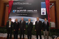 h will help build synergies between different initiatives and promote the complementary development of a regional database and Himalayan Spatial Data Infrastructure (HSDI).”
The launch ended in the official opening of the SERVIR-Himalaya Network through the present dignitaries.
For more information on SERVIR Himalaya...
The SERVIR-Himalaya system was being launched today, 5th October, by Mr. Charles F. Bolden Jr., NASA Administrator, and Mr. Michael Yates, Senior Deputy Assistant Administrator of USAID in Kathmandu.
Andreas Schild, Director General of ICIMOD, in his opening words communicated a message from his meeting with the Indian Minister of Environment and Forestry the previous day. First, India is considering ICIMOD as an anchor. Full cooperation of all regional countries and stakeholder is an attainable goal and the window of opportunity is widening.” Secondly, the Minister had emphasized India’s strong support regional cooperation based on strong national institutions.” Schild asked the present organistions to support ICIMOD in its task. He accepted the high obligation that the launch of SERVIR is putting on the organization in serving the stakeholders of the region. “We consider this as a very important and noble task.”
NASA Administrator Charles F. Bolden Jr. started his speech with sharing his experience from his first space expedition, when looking from a height of 600 km he realized that the world really only is one big body of water, which is only periodically interrupted by pieces of land. He explained how the human induced changes in the world have to be measured using all available knowledge sources. This means to combine space-based satellites with in-situ observations to make earth observation a predictive science. That is why NASA has reinvigorated its applied sciences program – to address immediate needs, nine of which have been identified by Global Earth Observation. He welcomed national cooperation between NASA and USAID and international body of GEOSS, to bring together the world’s earth observation agencies. Bolden closed his speech with the words “From space this is a world without borders – we all have a responsibility to cooperate to making our village, our country, our region and this planet a better place.”
The keynote address was delivered by Senior Deputy Assistant, USAID, Michael Yates. He spoke about the present trend within the US administration. “We are all looking for scientific collaboration as a true game-changer and SERVIR is a step into this direction. It combines NASA’s research and technology experience with USAID’s comprehensive development expertise from working with many partners around the world. “According to him, no single government ministry or organization can tackle all the available information offered in the different areas, “that is why SERVIR is the newest node in the vision of a truly global network. It will be powered by electricity but also by trust. We have to understand how people make decisions and how information can feed into that. That is why SERVIR will also bridge the gap to social science research as well.”
Basanta Shrestha, MENRIS Division Head, ICIMOD, had the floor for his presentation on “Bridging the data gap for climate change adaptation in the Hindu-Kush Himalayan (HKH) Region” which related the SERVIR launch back to the overall theme of the International Symposium. Upon outlining the major drivers of Climate Change he explained how it is creating a particular strain on the mountain ecosystem and the downstream areas affected. Mountain communities had demonstrated to be slow in adaptation and that is why ICIMOD’s focus and mission for many years has been to increase the adaptive capacity and resilience of mountain communities. “Our understanding on the complexity of the interlinking issues, however, is still at a very early stage and the HKH has been identified as a data gap region”. That is why ICIMOD is directing its various programs at the different aspects of that knowledge gap, just to name a few: Regional snow monitoring, Regional Mapping and Inventory of Glaciers, Mountain Biodiversity, Mountain Socio-cultural Diversity, Regional and national land cover mapping, Capacity building, Rapid response mapping together with JAXA WINDS, Satellite based Forest Fire Detection and Monitoring, Transboundary air pollution, Reaching the Users through the Mountain GeoPortal and GEOSS. “The way forward is through regional and international cooperation whic
 h will help build synergies between different initiatives and promote the complementary development of a regional database and Himalayan Spatial Data Infrastructure (HSDI).”
The launch ended in the official opening of the SERVIR-Himalaya Network through the present dignitaries.
For more information on SERVIR Himalaya...
"The future lies in regional cooperation based on strong national institutions," he added.
India's Environment and Forests Minister Jairam Ramesh has stressed the need for regional cooperation for the protection of Himalayan glaciers, an official release said Tuesday. Addressing a symposium on 'Bridging the Data Gap for Adaptation to Climate Change in the Hindu-Kush Himalayan Region' in Kathmandu, the minister reiterated the challenges facing the region and the need for solid scientific information as the basis for decision making and improving governance. "The future lies in regional cooperation based on strong national institutions," he added. More details...
Himalayan climate change action urged

More regional and bilateral cooperation is needed to tackle climate change in the Himalayas, an Indian official said. "The behavior of Himalayan glaciers is fundamentally different from that of glaciers in the polar regions and they need special investigation and analysis," Indian Minister for Environment and Forests Shri Jairam Ramesh said Monday, The Himalayan Times reports. Biodiversity does not stop at geographical boundaries and countries have no choice but to work together for protection and management and also to support adaptation," he said. More details...
Subscribe to:
Posts (Atom)