
This platform will enable the participants of the different events during the Symposium to interact virtually, stay updated on the ongoing sessions and provide a room for debate and creative exchanges.
Thursday, September 30, 2010
The Himalayan Times : Satellite to provide images of disasters
Full Article
KATHMANDU: A team of Japanese scientists has installed a receiver that will directly provide real time satellite imagery when natural disasters occur in the country. The receiver was installed on the premises of International Centre for Integrated Mountain Development (ICIMOD in Khumaltar of Lalitpur.
The team led by Shinya Tanaka, senior engineer at Japan Aerospace Exploration Agency (JAXA) installed the receiver. “This satellite receiver will provide direct real time satellite imageries of disaster afflicted areas directly which would help in rapid response mapping and monitoring of major disasters,” said Dr Giriraj Amarnath, remote sensing specialist at ICIMOD.
The JAXA WINDS (Wideband Internetworking Engineering Test and Demonstration Satellites ‘KIZUNA’) receiving station at ICIMOD will be formally launched on October 3.
Sentinel Asia is a voluntary initiative led by the Asia-Pacific Regional Space Agency Forum (APRSAF), which supports disaster management activity in the Asia-Pacific region by applying the Web- Geographic Information System (GIS) technology and space-based technology, such as earth observation satellite data. Such receivers have already been installed in Taiwan, the Philippines, Thailand and India with central server system in Japan.
At present five satellites, namely ALOS of Japan, KOMPSAT of Korea, THEOS of Thailand, FORMOSAT of Taiwan and Resourcesat-1 of India are currently operating as earth observatory satellites that focus on disaster-related issues.
During large-scale natural disasters, the satellite will focus on the site upon request from the authority here and regular images of the site can be directly accessed from Nepal as the receiver has been installed here. It will focus on implementation of satellite-data production systems for wildfire, flooding and Glacier Lake Outburst Flood (GLOF) information.
During emergency operations in times of disaster, emergency observation is requested from here. JAXA then allocates WINDS resources in line with the emergency observation request and satellite observation plan. Satellite observation data are then transferred via WINDS.
“Earth observation system is widely used during disasters and has been seen quite useful, so its promotion is the need of the hour and this satellite will be one of the best resources for understanding big natural disasters as we are very vulnerable to GLOF and big floods and landslides,” said Basanta Shrestha of ICIMOD.
Although crude satellite imagery is received directly, value added information like inundation area and total affected area can be extracted and simplified so that the public can easily understand. The WINDS system can perform high-speed communication at maximum speed of 155 Megabyte per second
Wednesday, September 29, 2010
NASA chief to talk climate here: The Kathmandu Post
The first coverage on the Earth Symposium was published in one of the leading Nepali newspapers "Kathmandu Post" on September 29, 2010:
Anil Giri - AHN News Correspondent
Kathmandu, Nepal (AHN) - The issue of climate change and its effects on Himalayan glaciers is becoming a cause of concern for the world’s environmental and scientific community. The National Aeronautics and Space Administration (NASA) is showing keen interest in building the regional capacity of at-risk mountain communities’ to adapt to the change.
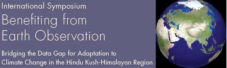
NASA Administrator Charles F. Bolden is arriving here Friday to attend a week-long high-level symposium on fostering regional and international cooperation to promote the use of and access to earth observation for improved scientific knowledge and understanding to support adaptation to climate change in the Hindu Kush-Himalayan (HKH) region. The HKH is the only reservoir of biodiversity that includes all or part of four global biodiversity hotspots.
Bolden will receive VIP treatment from the Ministry of Foreign Affairs. He will meet Prime Minister Madhav Kumar Nepal and other senior government officials during his stay in Kathmandu.
According to the itinerary provided by the International Center for Integrated Mountain Development (ICIMOD), one of the organisers of his Nepal trip, he will be launching SERVIR Himalaya, an earth observatory that monitors and visualizes systems that integrate satellite and other geospatial data for improved scientific knowledge and decision-making by managers, researchers, students and the general public.
“SERVIR provides a model for building the capacity of countries to use earth observations and geospatial information technologies in regions around the world,” said ICIMOD.
More than 250 delegates from 24 countries — scientists, researchers and development practitioners, as well as policy makers from the HKH region and beyond will be participating. Michael Yates, senior deputy assistant administrator of USAID, Indian Minister of State for Environment and Forest Jairam Ramesh, Group on Earth Observation (GEO) Secretariat Director Prof. Jose Achache of Switzerland are expected to attend the symposium.
The jamboree of researchers and policy makers, the first of its kind in Nepal, will discuss remote sensing of snow, glaciers, spatial decision support systems for ecosystem management, space-based information for disaster management, land cover change and carbon socks, trans-boundary air pollution monitoring and spatial data infrastructure for climate change adaptation.
“The systematic collection of data and information about the HKH mountain system is critical for improved understanding of climate change, and its trends and impacts for protecting future scenarios. Data and information derived from Earth observation are proving increasingly vital to gaining insights into regional status and trends, especially climatic implications at the global level,” ICIMOD said in a briefing.
Anil Giri - AHN News Correspondent
Kathmandu, Nepal (AHN) - The issue of climate change and its effects on Himalayan glaciers is becoming a cause of concern for the world’s environmental and scientific community. The National Aeronautics and Space Administration (NASA) is showing keen interest in building the regional capacity of at-risk mountain communities’ to adapt to the change.
NASA Administrator Charles F. Bolden is arriving here Friday to attend a week-long high-level symposium on fostering regional and international cooperation to promote the use of and access to earth observation for improved scientific knowledge and understanding to support adaptation to climate change in the Hindu Kush-Himalayan (HKH) region. The HKH is the only reservoir of biodiversity that includes all or part of four global biodiversity hotspots.
Bolden will receive VIP treatment from the Ministry of Foreign Affairs. He will meet Prime Minister Madhav Kumar Nepal and other senior government officials during his stay in Kathmandu.
According to the itinerary provided by the International Center for Integrated Mountain Development (ICIMOD), one of the organisers of his Nepal trip, he will be launching SERVIR Himalaya, an earth observatory that monitors and visualizes systems that integrate satellite and other geospatial data for improved scientific knowledge and decision-making by managers, researchers, students and the general public.
“SERVIR provides a model for building the capacity of countries to use earth observations and geospatial information technologies in regions around the world,” said ICIMOD.
More than 250 delegates from 24 countries — scientists, researchers and development practitioners, as well as policy makers from the HKH region and beyond will be participating. Michael Yates, senior deputy assistant administrator of USAID, Indian Minister of State for Environment and Forest Jairam Ramesh, Group on Earth Observation (GEO) Secretariat Director Prof. Jose Achache of Switzerland are expected to attend the symposium.
The jamboree of researchers and policy makers, the first of its kind in Nepal, will discuss remote sensing of snow, glaciers, spatial decision support systems for ecosystem management, space-based information for disaster management, land cover change and carbon socks, trans-boundary air pollution monitoring and spatial data infrastructure for climate change adaptation.
“The systematic collection of data and information about the HKH mountain system is critical for improved understanding of climate change, and its trends and impacts for protecting future scenarios. Data and information derived from Earth observation are proving increasingly vital to gaining insights into regional status and trends, especially climatic implications at the global level,” ICIMOD said in a briefing.
Subscribe to:
Posts (Atom)