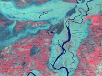
SERVIR works from space to village, bringing people and their environment into harmony. SERVIR does this by providing access to data and models, coupled with training and capacity building that can be used to help decision makers and their constituencies with climate change, environmental monitoring, and assessment of extreme events. In fact, SERVIR-Himalaya has already been helping to map the recent flooding in Pakistan, shown below, through USAID support and NASA satellite data. More details...