 Today’s afternoon programme saw the two first technical sessions of the International Symposium on Benefiting from Earth Observation. The first theme was Space-based Information for Disaster Management. While most of the speakers presented opportunities of space-based information for disasters caused by fires, floods, GLOFs and earth quakes, a common theme of the session was on communicating these opportunities to policy- and decision-makers. The interface between the communities and the experts, as well as the politicians and the specified data would have another important benefit. To contribute to disaster prevention and preparedness. Institutions such as UN-Spider and SERVIR are already readily providing disaster-related data. However, only ten countries are signatories to the International Charter on and still most countries are lacking the capacity to actually activate the charter. The policy support and the condensing of information therefore – next to the gathering and analysis of it – becomes a key area for involvement.
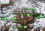
The second Thematic Session dealt with the Remoting Sensing of Cryosphere and focused on the issues of snow cover mapping and modeling. Much of the papers presented focused on the improvement of accuracy of the predominant MODIS snow cover algorithm. Several factors, such as mountain shadows, (ice) clouds, and the snow albedo effect in particular in higher altitudes, have been reducing the accuracy of conventional algorithms. A second session dedicated to the cryosphere is planned for tomorrow morning and will focus on glacier mapping and monitoring.